

石油 & 自然气
海上勘探
A Prospectivity Map is defined as the final product of the integration of data acquisition, processing and interpretation during the different stages of a project. A categorization and weighting is included, which is defined by the information obtained through different multispectral and hyperspectral interpretation technique, structural maps, etc. A prospectivity scale of the different targets is made after the final weighting.
This product helps geologists and engineers in the area selection process in off-shore basins for its subsequent posterior detailed exploration. Information provided by clients can be integrated with this product.

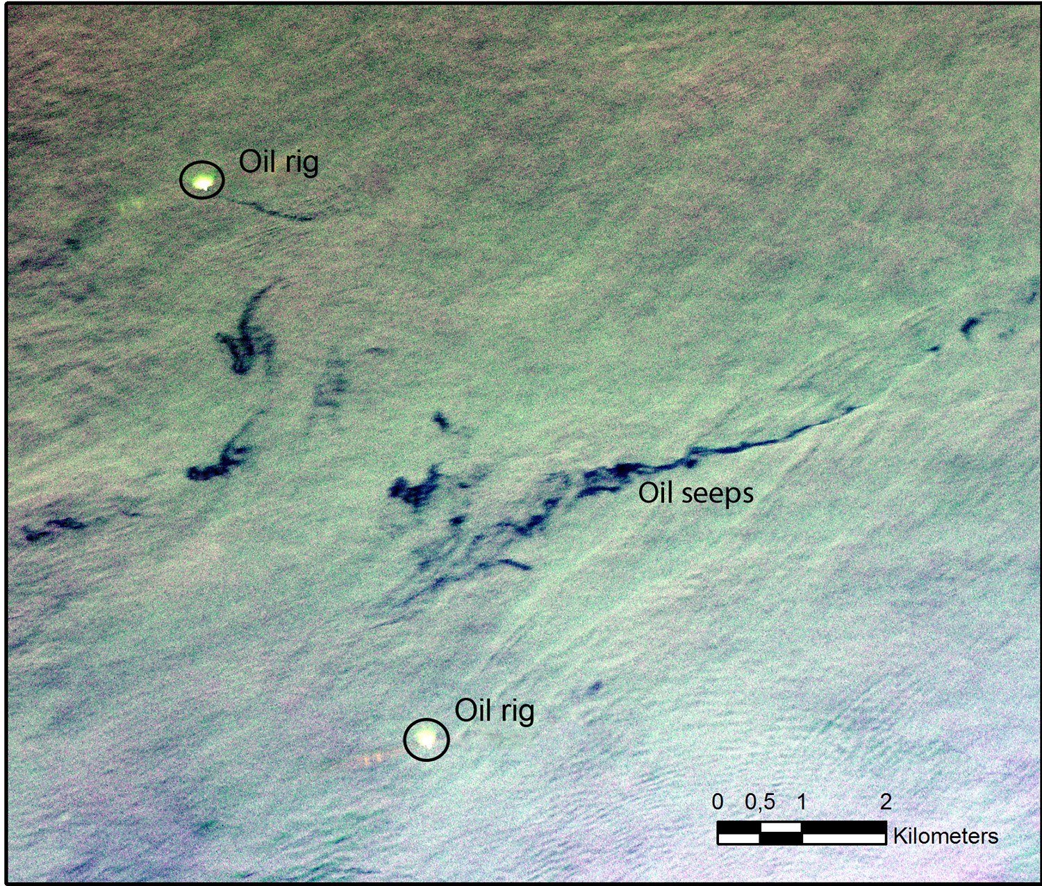
The natural emanations of gas and oil have always provided valuable information to oil explorers in order to identify and evaluate the sedimentary basins in the frontier areas. These emanations indicate the presence of hydrocarbon source rocks in the depth.
Due to the high cost of off-shore exploration, the identification of natural hydrocarbons emanations over the surface of the oceans has become a widely accepted methodology in the risk evaluation of off-shore basins.
These emanations can be identified through the processing and interpretation of radar and hyperspectral images. These types of images allow the differentiation and definition of the localization and size of the surficial manifestation of hydrocarbons in a certain exploratory block.
The detection of off-shore seeps is done through the multitemporal analysis of radar images. This also allows the differentiation of natural occurrences and accidental spills from the weighting scales of the probabilities of these phenomena.


Thermal images taken both during day and night, are used to prepare emissivity maps that provide clues about materials and substances present in the terrain surface or in water bodies.

Thermal images taken both during day and night, are used to prepare emissivity maps that provide clues about materials and substances present in the terrain surface or in water bodies.

Thermal images taken both during day and night, are used to prepare emissivity maps that provide clues about materials and substances present in the terrain surface or in water bodies.
