
GEOTHERMAL RESOURCES
Remote sensing is useful in geothermal applications because the heat emitted by objects can be detected in the thermal infrared. The data collected in this region of the electromagnetic spectrum provides concise information regarding the thermal properties of various terrain features, and can be used in the exploration and potential assessment of geothermal wells and temperature mapping.


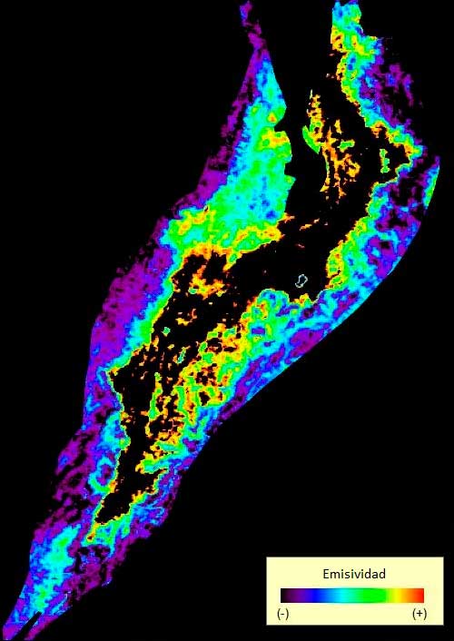
An image obtained from wavelengths of thermal infrared is the response of the bodies located on the terrain surface at a certain temperature, and that consequently emit an electromagnetic radiation. The emissivity of the images can be compared to the brightness temperature scale.

Daytime and nighttime thermal shots from the same area are employed to calculate the apparent thermal inertia. Its values can be directly related to different surface compounds and rock types, and they are a response to the resistance of some materials to change their temperature.

A structural map is the spatial representation of the fragile and/or ductile deformation that affects the crust. The map represents the symmetry and the geometry of surficial forms that resulted from the terrain deformations.

A lineament is a straight or curvilinear structural feature of a terrain. It may also appear as an alignment of linear or discontinuous patterns. Lineaments are useful in determining regional and sub-continental fracture patterns that reveal some of the stress history of large crustal units.
